Editable Thailand Map Outline PowerPoint Presentation

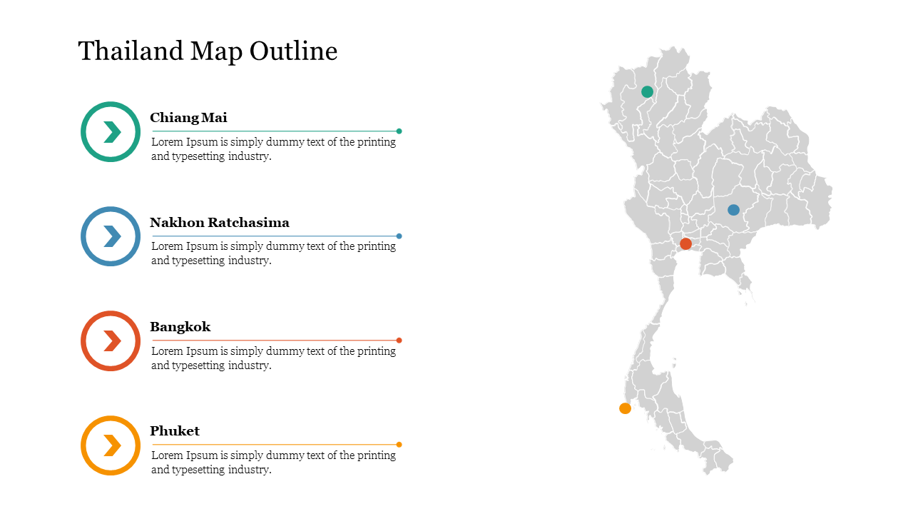
Thailand map outline with color coded markers, and four cities listed with corresponding icons on the left.
P.ID : 62245
    13 slides
    Map slides of Michigan featuring upper and lower Peninsula counties in red and blue, along with geographic details.
    16 slides
    Slide deck featuring various Texas county maps with different colors and layouts for presentations.
    14 slides
    A pack of slides showing the map of Northeast region of the US, with each state highlighted in different colors.
    324 views
    56 Downloads
    Get Custom Slides by Experts
    Instantly Access Templates in PowerPoint

    Editable Thailand Map PowerPoint Presentation


    This Thailand map outline template is ideal for educating your audience about Thailand or launching a product in the country. The map slide is also suitable for students, researchers, and educators, who can create informative slideshows.


    About this template


    The Thailand Map Outline template is the best presentation tool to enhance your presentation. You can customize the Editable Thailand Map Outline PowerPoint template to meet your needs. You can also change the text and colors to suit your needs. You can also highlight the different shapes in the map to make navigating. To download more map template visit SlideEgg.


    Feature of this template  


    • The Slides are available in different nodes & colors.
    • This slide contains 16:9 and 4:3 format.
    • It is easy to change the slide colors quickly.
    • It is a well-crafted template with an instant download facility.
    • The best PowerPoint theme template.
    • It is a well-designed presentation template.
    Advertisement

    You May Also Like These PowerPoint Templates

    Add to Wishlist
    Download
    AI Customize
    Editable USA Map PowerPoint Presentation PPT Slide
    Add to Wishlist
    Download
    AI Customize
    Creative Central America Map Outline Presentation Slide
    Add to Wishlist
    Download
    AI Customize
    Effective South Carolina Counties Map Presentation
    Add to Wishlist
    Download
    AI Customize
    A  county map of Kenya, highlighting specific regions having four  textboxes for detailed presentation.
    Add to Wishlist
    Download
    AI Customize
    Jamaica map slide outline with clear boundaries dividing the island's parishes with many labeled regions.
    Add to Wishlist
    Download
    AI Customize
    Color-coded map of Singapore slide highlighting different regions: northwest, northeast, central, southwest, and southeast.
    Add to Wishlist
    Download
    AI Customize
    Slide featuring a map of the United States highlighting Washington D.C. with a red dot and text area on the right.
    Free
    Add to Wishlist
    Download
    AI Customize
    Asia map slide with highlighted countries in different colors, labeled with text for location details.
    Add to Wishlist
    Download
    AI Customize
    UK map in varying shades of blue and four captions arranged vertically on the right, on a white background.
    Add to Wishlist
    Download
    AI Customize
    Visual representation of the four asian tigers with a map highlighting south korea, taiwan, hong kong, and singapore.
    Add to Wishlist
    Download
    AI Customize
    Color-coded map highlighting India, Bhutan, Bangladesh, and surrounding countries with five caption areas.
    Add to Wishlist
    Download
    AI Customize
    Asia Pacific map highlighting key countries with color-coded markers and space for corresponding descriptive text.
    Add to Wishlist
    Download
    AI Customize
    A world map slide showing continents with distinct colors and labels on a white background.
    Add to Wishlist
    Download
    AI Customize
    Indonesia Map PPT Download PowerPoint Presentation Slides
    Add to Wishlist
    Download
    AI Customize
    World map showing five continents in blue and green tones with black and white location markers.
    Add to Wishlist
    Download
    AI Customize
    Outline map of Puerto Rico with key cities labeled, connected by lines to labeled boxes with a teal border.