PowerPoint Country Maps for Global Presentations Success
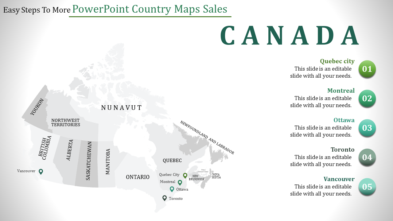
Canada Map PowerPoint Template and Google Slides
The "Canada Map PowerPoint Template and Google Slides" offers a detailed map of Canada, highlighting various states within the country. Accompanied by five captions, this template provides an informative visual aid for presentations where Canadian geography plays a significant role. The highlighted states in the map correspond to the captions, adding clarity and context to the information presented.
This template is ideal for a wide range of presentations where Canadian geography is relevant. Whether delivering reports on regional sales, demographic analysis, tourism trends, or political developments, this template provides a clear visual representation of Canada's states. It can be effectively used by business professionals, educators, researchers, and policymakers who need to convey information related to Canada and its regions.
Compatibility with PowerPoint and Google Slides. Available in 16:9 and 4:3 aspect ratios, catering to different screen sizes and presentation preferences. Provided in ZIP format for easy sharing and distribution. 100% customizable features. Download now.
You May Also Like These PowerPoint Templates
Free
